
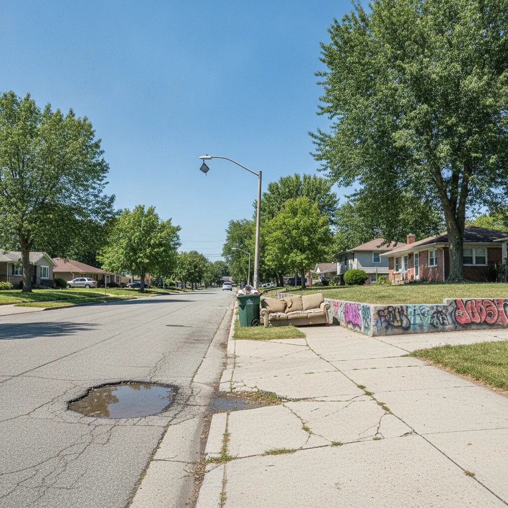
Help your local government help your community
Spot a pothole, a broken streetlight, some graffiti? Reporting it is the first step to the fix, and your local agencies want to hear it. We route your report to whichever government is responsible, automatically.
Ready to report an issue?
No account needed. We'll email you a link to confirm and track it, and route your report to the right agency automatically.
Have an account? Sign in • Create one • Covers California and Massachusetts
Community improvement is a team effort
Every report is a small act of community improvement: a partnership between the people who live somewhere and the government that serves it. You know your street; they have the crews and the budget. Reporting an issue is how the two meet.
You bring the local knowledge
You see the problem first: where it is, what it is, why it matters.
Government brings the fix
Agencies want these reports; it's how they find and prioritize the work.
Your community benefits
One report can fix something for an entire neighborhood.
Why UnGovr Request?
Most service-request systems only work within a single city or county. But government jurisdictions overlap. A pothole might be on a county road inside city limits. A water issue might belong to a special district, not the city.
UnGovr Request uses geographic boundary data covering every jurisdiction to identify the correct agency for your report and route it there automatically. You don't need to know which agency is responsible. Just describe the problem.
How It Works
Three steps. No bureaucracy.
Report
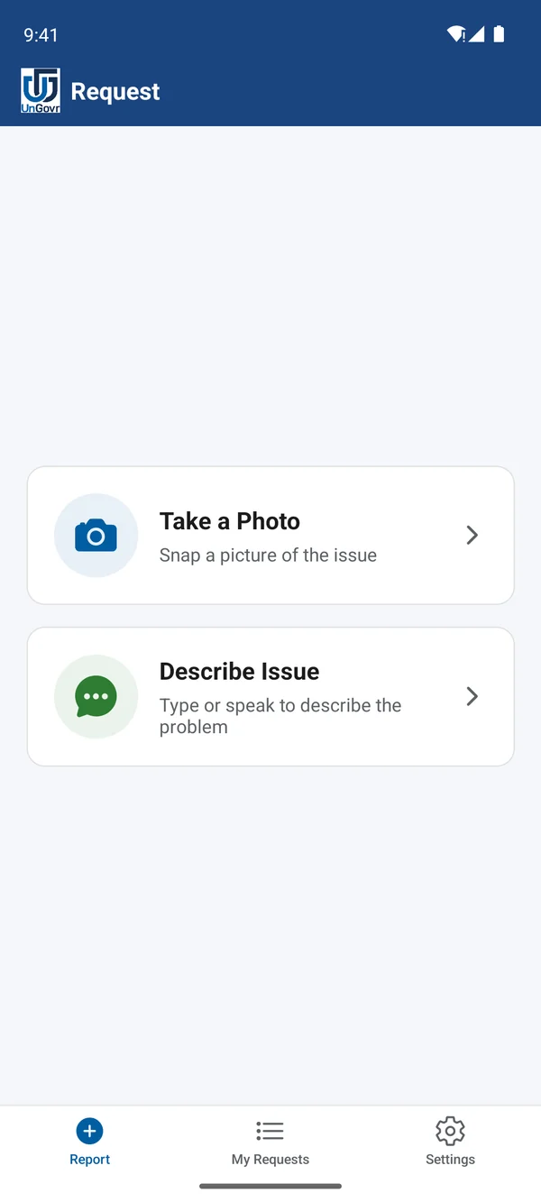
Snap a photo, type, or speak a description, then share your location. Takes under a minute.
Route
UnGovr Request identifies every jurisdiction at that location and routes your report to the responsible agency.
Resolve
Your local government receives the report in the workflow they already use and acts on it. You can follow the status until it's resolved.
See what's being reported near you
Every pin is a neighbor who spoke up, and a fix their local government can take on.
No reports here yet.
Be the first to report →Report issues on the go
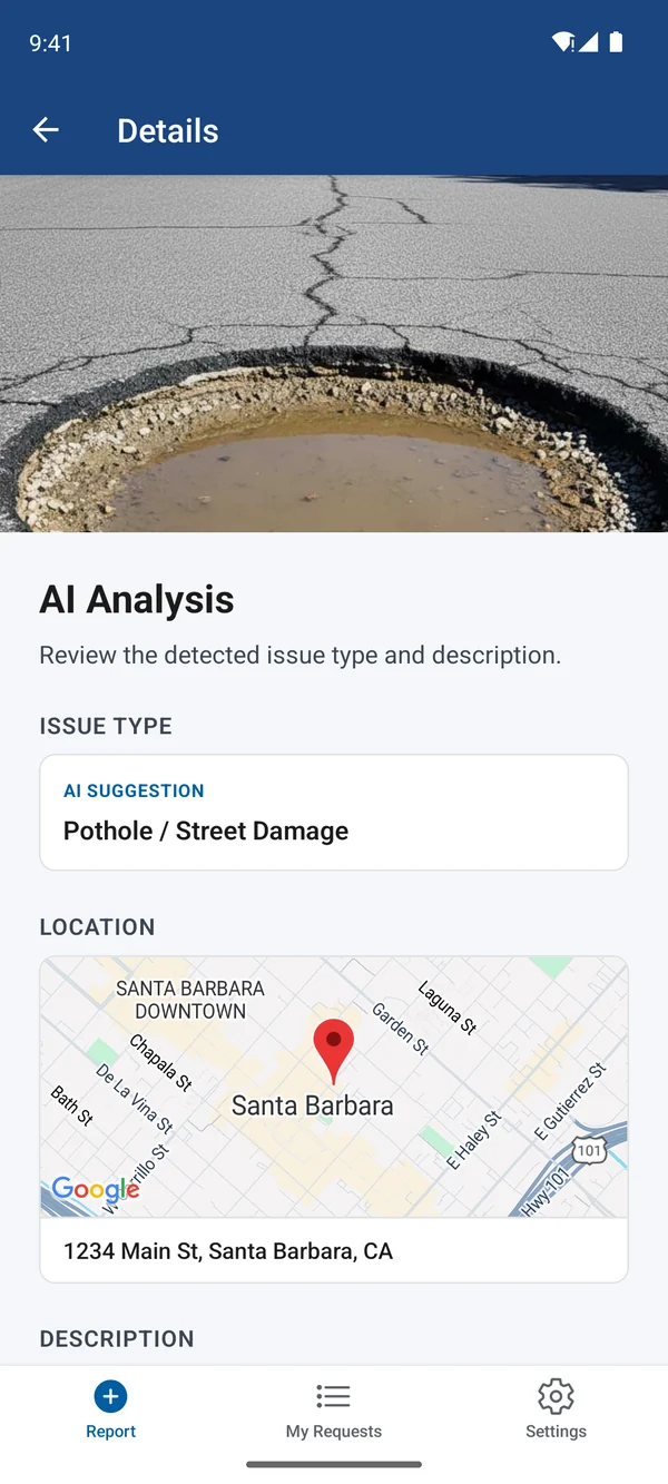
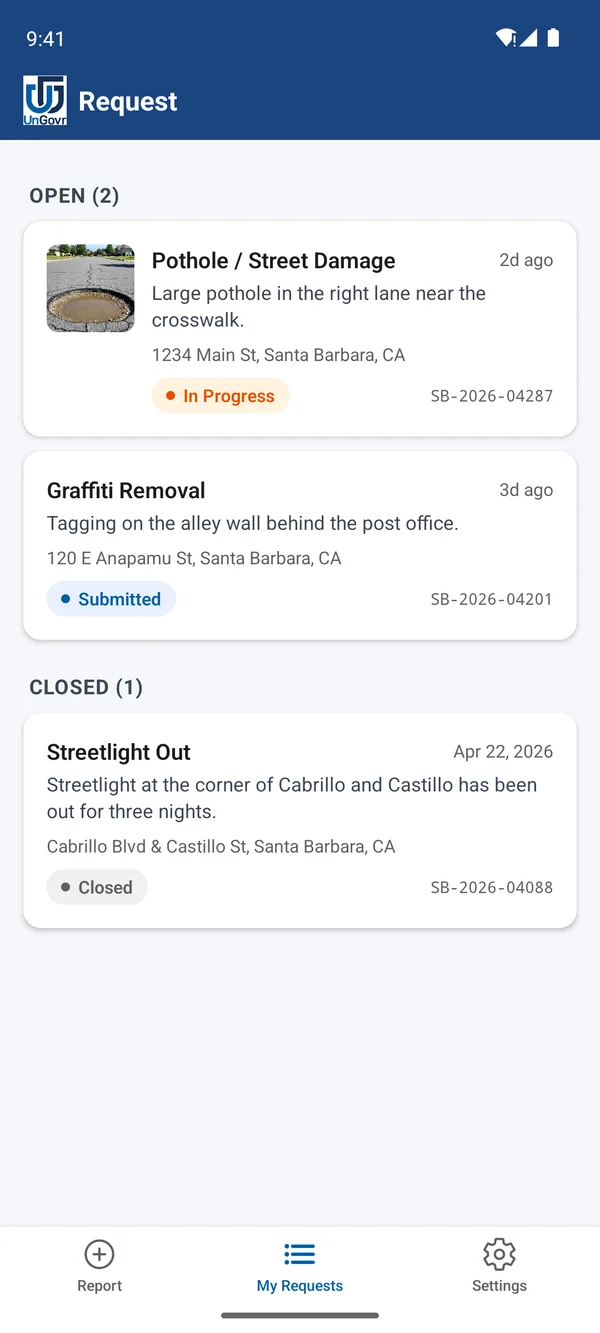
The UnGovr Request app puts civic reporting in your pocket. Report by photo, text, or voice and let UnGovr route it to the right place — in under a minute.
Built for How Government Works
Cross-jurisdiction routing
Automatically identifies which agency is responsible from the report location and issue type: city, county, special district, or state.
Three ways to report
Snap a photo, type a description, or use your voice. Every channel feeds the same routing system.
AI-assisted categorization
Reads your photo or description to suggest the right category and location, so reports land in the correct queue.
Track status end to end
Every report gets a tracking code and a clear status: submitted, in progress, or closed.
Ready to report an issue?
No account needed. Report in about a minute and we'll email you a link to confirm and track it.